-40%
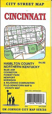
City Street Map of Cincinnati, Ohio, by GMJ
$ 2.61
- Description
- Size Guide
Description
City Street Map of Cincinnati, Ohio, by GMJA detailed and up to date city street map of
Cincinnati, Ohio.
Also covers;
Maud, Booth, Academy, Public, Landing, Mount Healthy, Newport, Newtown, North College Hill, Norwood, Park Hills, Reading, Saint Bernard, Sharonville, Silverton, Southgate, Villa Hills, Woodlawn, Wyoming, Fairfax, Glendale, Golf Manor, Greenhills, Kenton Vale, Lincoln Heights, Lockland, Ludlow, Madeira, Mariemont, Amberley, Arlington Heights, Bellevue, Blue Ash, Bromley, Cheviot, Dayton, Deer Park, Elmwood Place, Evendale, Cincinnati*, Covington*, Crescent Springs*, Erlanger*, Forest Park*, Fort Mitchell*, Fort Thomas, Fort Wright*, Indian Hill*, Montgomery*, Springdale*, Terrace Park*, Wilder*, Hamilton County*, Boone County*, Butler County*, Campbell County*, Clermont County*, Kenton County*, and Warren County* (* Partial Coverage)
Map measures 36" x 27" when opened and if fully indexed.
Publication date: 2007, ISBN
9781897359389
Map is brand new, this is the current edition.


